OpenRoads Designer is used for all types and phases of civil projects, large and small, by users at every level of expertise. It handles a wide variety of complex tasks with ease, including interchange design, roundabout design, site development, sanitary and stormwater network design, and the production of construction staking reports.
Data and Design Integration
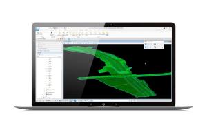
OpenRoads makes collaborating on 2D and 3D models easier and more efficient than ever. From team-level, work-in-progress collaboration to project-level, multidiscipline coordination, project managers, reviewers, site workers, and inspectors can view designs, perform virtual walkthroughs, query model information, and analyze embedded property data. These tasks can all be done directly in the OpenRoads application or using a web browser.
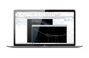
Detailed Road Design
OpenRoads is all you need for geometrics, survey, drainage, utilities, quantity takeoff, cut/fill, site grading, lane configurations, and mobility. Roadway designers and engineers require software that seamlessly collaborates across disciplines, addresses growing industry demands, and includes automation to remove tedious manual work. Whether you need to produce traditional 2D deliverables, advance to 3D modeling, support digital transformation, or all the above, OpenRoads is the choice for road design.
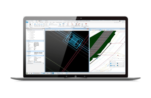
Drainage and Utilities
3D models of drainage and utilities are quickly becoming a necessity; however, road design, drainage design, and utilities modeling are often completed by separate team members utilizing different software. Working in a vacuum leads to lack of coordination across disciplines, costly mistakes from out-of-date data, and missed opportunities to address conflicts. OpenRoads can help you with everything from the creation of models from 2D artifacts and external data, through steady and unsteady state hydraulics and hydrology, to BIM and plans production.
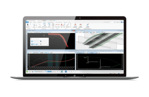
Even as the transportation industry is moving towards the creation of 3D models, the need for a variety of deliverables continues to be part of the project workflow. With OpenRoads, you can create whatever deliverables you might need. Whether it is 2D or 3D, plans or models, digital or paper, OpenRoads is designed to allow you to work in all these arenas simultaneously, leveraging information from one to help populate the other. Our 3D models can be leveraged for 4D scheduling and 5D cost estimation, bringing your design to constructed fruition, on time and on budget.
The key to your success goes beyond the software you use. It is also dependent on doing business the way that best serves your organization. That is why we have a variety of subscription and license options, as well as 24/7/365 support to ensure you are up and running on your software quickly and continuously. Bentley can work with your organization to build a path forward that supports people, process, and technology. Unlike others in the industry, we provide innovative subscription programs that are designed to ensure that your team is equipped
to do their work and receive timely support from product experts. Choose from term licensing, use-based pricing, hosted and on-premise services, and cloud services, all of which include use analysis and the flexibility to pivot as needed.